Imbabura (volcano)
Imbabura (volcano)
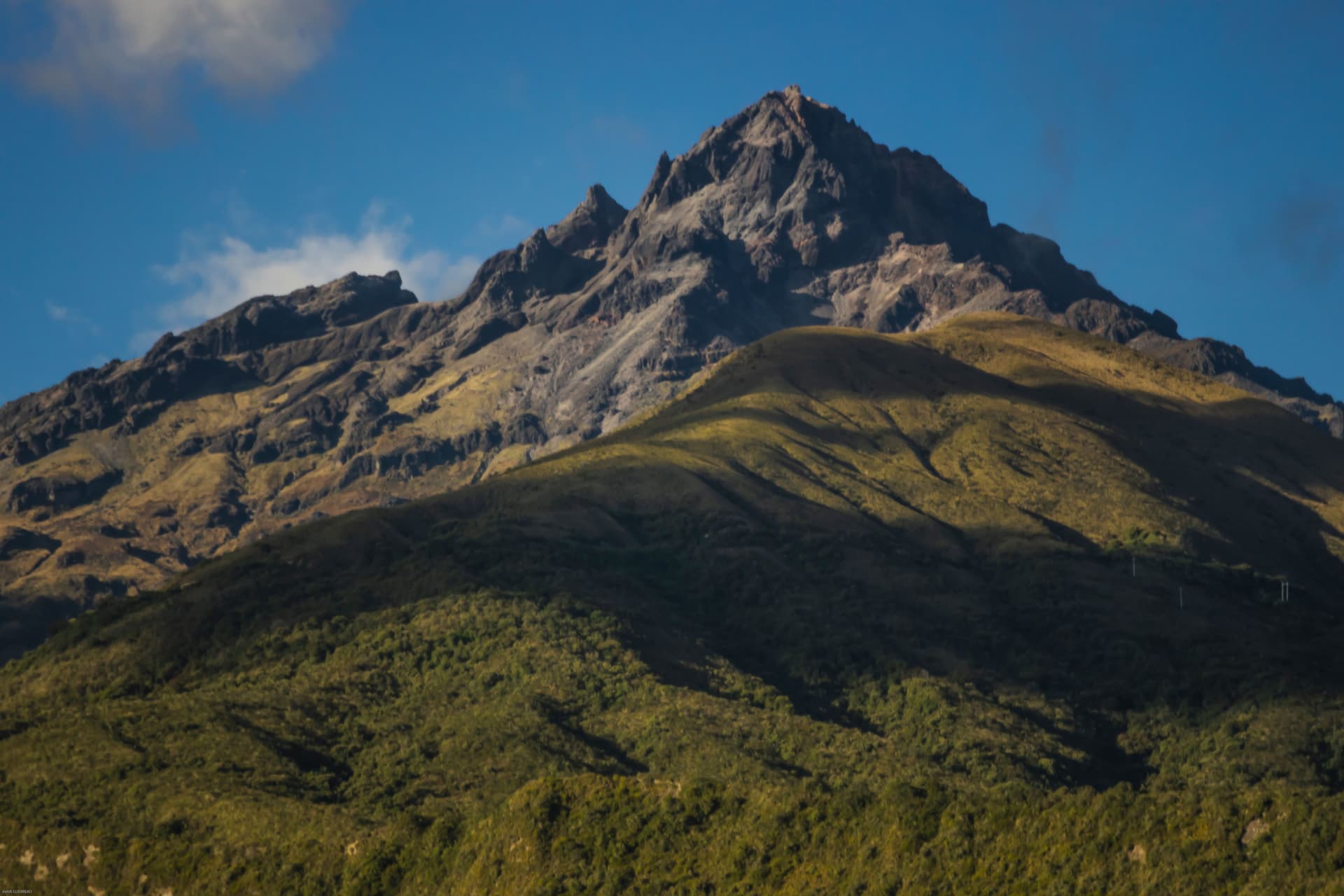
A dormant stratovolcano at 4,630 m, Imbabura dominates the northern Sierra of Ecuador. Revered as 'Father Imbabura' by Kichwa communities, it offers a challenging hike and sweeping views of Andean lakes.
Volcano Imbabura dominates the province that bears its name at an altitude of 4,630 meters. Visible from Ibarra, Otavalo and Cotacachi, this dormant stratovolcano shapes the landscape across Ecuador's northern Sierra. Kichwa communities revere it as Taita Imbabura — 'Father Imbabura' — and attribute to it a protective presence. Its ascent attracts hikers, but it is also an omnipresent cultural and visual landmark throughout the region.
Quick facts
- Summit altitude: 4,630 m
- Access: typical departure from La Esperanza, a village south of Ibarra
- Ascent duration: 6 to 8 hours round trip depending on fitness level
- Difficulty: challenging hike, no mountaineering technique required but good physical condition essential
- What to wear: warm and waterproof clothing, high-ankle hiking boots
- Local guide: strongly recommended — the trail is not always marked
What you'll see
The ascent passes through several vegetation zones: Andean grasslands (páramo), rocky areas and, on clear days, panoramic views of Lake San Pablo, Otavalo, Ibarra and neighboring volcanoes Cayambe and Cotacachi. The summit crater is covered in low vegetation. Clouds frequently cling to the summit in the afternoon.
History and context
Imbabura is a dormant volcano whose last significant activity dates back several centuries. The province surrounding it has borne its name since colonial times. For the Kichwa peoples of the region, Taita Imbabura forms a mythical couple with Cotacachi volcano, known as Mama Cotacachi. When Cotacachi is snow-capped, tradition says Imbabura paid her a visit during the night.
Highlights of the visit
The páramo at sunrise
Departing early from La Esperanza allows you to reach the higher zones before clouds form. The low-angle morning light reveals the textures of the páramo and the reflections of Lake San Pablo below.
Panorama of the Andean lakes
On clear days, Lake San Pablo (Imbacocha) appears clearly at the foot of the volcano. Further away, Lake Cuicocha, in the crater of Cotacachi, is visible to the west. This dual lake panorama is rare in the Ecuadorian Andes.
The Kichwa cultural dimension
The village of La Esperanza, the classic starting point, is inhabited by Kichwa communities. Engaging a local guide from these communities enriches the hike with a cultural reading of the territory that signboards cannot offer.
Photography tips
The volcano photographs beautifully from Otavalo with Lake San Pablo in the foreground — a classic angle from the Pan-American Highway. During the ascent, the best valley views are between 3,500 and 4,000 m, before vegetation disappears. Avoid afternoons: clouds regularly cover the summit from 1 p.m. onward.
Location and access
Volcano Imbabura lies between the cities of Ibarra (to the north) and Otavalo (to the south), in Imbabura province. The most commonly used starting point is La Esperanza, accessible by taxi or bus from Ibarra. From Quito, the province is approximately two hours north by the Pan-American Highway. Local agencies in Otavalo and Ibarra offer guided ascents.
In the area
- Otavalo Market — the largest indigenous craft market in South America, less than an hour to the south.
- Lake San Pablo (Imbacocha) — Andean lake at the foot of the volcano, ideal for a stop after the hike.
- Lake Cuicocha — crater lake of Cotacachi volcano, accessible from Cotacachi or Otavalo.
- Ibarra — provincial capital nicknamed 'the white city', known for its sugarcane ice cream (helados de paila).
- Cotacachi — city renowned for its leather crafts, at the foot of the volcano of the same name.
Frequently asked questions
A local guide is strongly recommended. The trail is not marked throughout its length and fog can disorient you quickly. Agencies in Ibarra and Otavalo organize guided ascents.
The dry season (June to September) offers the best chance of clear skies. Outside this period, clouds and rain are frequent, especially in the afternoon.
Yes. The main Otavalo market takes place Saturday mornings. A common approach is to visit the market early, then dedicate the next day to the ascent from La Esperanza.
The ascent is long and conducted at altitude. Good cardiovascular fitness is essential. No mountaineering technique is required, but the elevation gain and altitude (4,630 m) should not be underestimated.
La Esperanza, south of Ibarra, is the classic starting point. Ibarra is the closest logistical hub; Otavalo works well too if you are staying in the southern part of the province.
Want to discover this destination?
Our local advisors design your tailor-made trip.