The Pastaza River
The Pastaza River
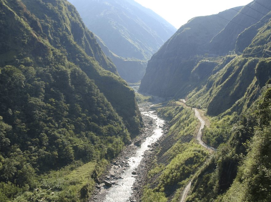
Born near Baños de Agua Santa, the Pastaza flows from the Andean volcanoes to the Amazonian plains over nearly 740 km, dotted with cascades and rapids.
The Pastaza River flows across Équateur from west to east before joining the Marañón River in southern Peru, of which it is a tributary. Over its roughly 740 km course, more than 300 km wind through the Amazon. Its formation at the confluence of the Patate and Chambo rivers near Baños de Agua Santa makes it one of the major water systems in Tungurahua province, at the crossroads between the Andes and the Amazonian rainforest.
Why visit the Pastaza River
The Pastaza brings together two Ecuadorian worlds in a single basin: the high Andean plateaus, where the Patate River cascades down the slopes of the Cotopaxi volcano (approximately 5,897 m), and the Amazonian plains, where the course widens and slows. This abrupt geographical transition explains the succession of gorges, rapids, and waterfalls that line the valley between Baños and Puyo.
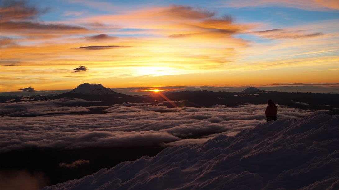
For travelers, the river serves as a guiding thread for several structured activities: rafting and canoeing from Baños, hiking along the riverbanks, and viewing waterfalls from suspension bridges or specially designed platforms. The volcanoes framing the basin – Cotopaxi to the north, Chimborazo (6,263 m) to the west, Sangay and Tungurahua to the east – add a distinctive volcanic horizon to the landscapes you'll encounter.
What to see along the Pastaza
The Ruta de las Cascadas
Between Baños de Agua Santa and the Amazonian town of Puyo, a road of about sixty kilometers runs alongside the river and features a succession of waterfalls. This route is known locally as the Ruta de las Cascadas. You can travel it by car, shared taxi, bicycle, or quad depending on your preferred pace.
Signature waterfalls
- Pailón del Diablo: the most famous, accessible via a well-maintained trail and walkways that let you get close to the falls.
- Manto de la Novia: visible from the road, crossable by tarabita (artisanal cable car) that spans the gorge.
- Agoyán: associated with a hydroelectric dam, located shortly after leaving Baños.
- Several smaller waterfalls border the route, often marked by small parking areas.
Surrounding volcanoes
From the valley, you can see Tungurahua (approximately 5,023 m) when conditions permit – an active volcano with often-snow-covered slopes – Cotopaxi upstream, and Sangay toward the southeast. Chimborazo, Équateur's highest peak, frames the western horizon.
Practical information
Rafting and canoeing
Sections downstream from Baños offer descents rated between levels III and IV depending on the stretch and water flow. Several local agencies guide outings with equipment provided (wetsuit, life jacket, helmet, paddle) and certified guides. Plan on 1.5 to 3 hours on the water, transport included. Beginners can opt for calmer sections or the nearby Patate River.
Visiting the waterfalls
The trail to Pailón del Diablo requires a 20 to 30-minute walk from the parking area, with wet stairs and narrow passages. Wear closed-toe shoes and bring waterproof clothing. A modest entrance fee is charged at the main sites.
Safety
Water flow varies significantly with rainfall. Guides adapt routes accordingly, but it's recommended to book with recognized operators in Baños and verify that equipment is in good condition before entering the water.
When to visit
The Baños region experiences a humid climate year-round, but two trends stand out:
- June to September: lower rainfall, clearer skies over the volcanoes, moderate flow favoring beginner rafting.
- February to May: rainier season, high flow, spectacular waterfalls but challenging routes reserved for experienced paddlers.
The transition months (October-November) often offer a good balance between visitor numbers and conditions.
How to get there
Baños de Agua Santa, the logical starting point, lies about 3.5 hours by road from Quito and 1 hour from Ambato. Direct buses connect the capital daily to Baños terminal. To travel the Ruta de las Cascadas, several options are available:
- Bicycle rental by the day in Baños (gradual descent to Río Verde).
- Chivas (open-sided tour buses) that stop at major waterfalls.
- Shared taxis or rental cars for a flexible pace.
What to see nearby
- Baños de Agua Santa: thermal resort at the foot of Tungurahua, the region's tourism hub.
- Puyo: gateway to Ecuadorian Amazonia, about 1 hour by road.
- Les Tunnels carved into the rock along the Ruta de las Cascadas.
- El Nariz del Diablo, the famous Andean railway section.
- Fuya Fuya, an acclimatization peak accessible further north.
Frequently asked questions
Approximately 740 km in total, of which more than 300 km flow through the Amazonian rainforest before converging with the Marañón in Peru.
It originates at the confluence of the Patate and Chambo rivers near Baños de Agua Santa, in Tungurahua province, north of the volcano of the same name.
Some sections departing from Baños are suited to beginners, but other stretches are rated level III-IV. The choice depends on flow and experience: a prior conversation with the operator is essential.
Pailón del Diablo, accessible from the village of Río Verde on the Ruta de las Cascadas, is the most visited waterfall in the valley.
A half-day suffices for the main stops; a full day allows you to visit several waterfalls in depth and include an activity such as rafting or a tarabita ride.
Plan your trip
The Pastaza River fits naturally into an Andes-to-Amazon itinerary, between Quito, Baños, and the Puyo region. To build a balanced trip combining volcanoes, waterfalls, and rainforest, explore our Équateur travel suggestions.
Interested in this visit?
We can include it in your personalised itinerary.