Fuya Fuya
Fuya Fuya
Caldera of the Mojanda volcanic complex 17 km from Otavalo, Fuya Fuya combines high-altitude climbing, three crater lakes and páramo landscapes.
Fuya Fuya is a caldera of an ancient volcano located 17 km south of Otavalo, in the northern Ecuadorian Andes. It is part of the Mojanda volcanic complex, a 5 km expanse dominated by three crater lakes and a páramo ecosystem. Its moderate altitude and well-marked trails make it a popular hike for acclimatizing before tackling more demanding peaks.
Why visit Fuya Fuya
Fuya Fuya offers three compelling reasons to detour from Otavalo. First, its summit (approximately 4,263 m) remains accessible to walkers in good condition, without technical equipment. Second, it serves as an ideal acclimatization stage before attempting Cotopaxi, Chimborazo or other Ecuadorian volcanoes: the climb challenges the body at altitude without requiring a multi-day commitment. Finally, the site combines páramo landscapes, caldera lakes and panoramas of surrounding peaks in an atmosphere that recalls, on certain mornings, the Scottish highlands under cloud cover.
The complex has been under protection by the local government since 2008, which has helped preserve high-altitude vegetation and wildlife.
What to see and do
The three Mojanda lakes
The Mojanda lagoon is a caldera perched above 3,720 m, which harbors three distinct lakes:
- Karikucha Lake ("male lake" in Kichwa): the largest of the three, accessible directly from the main parking area.
- Yanakucha Lake ("black lagoon"): with dark waters, often considered the most photogenic site.
- Warmikucha Lake ("women's lagoon"): the smallest, set apart from main trails.
The summit ascent
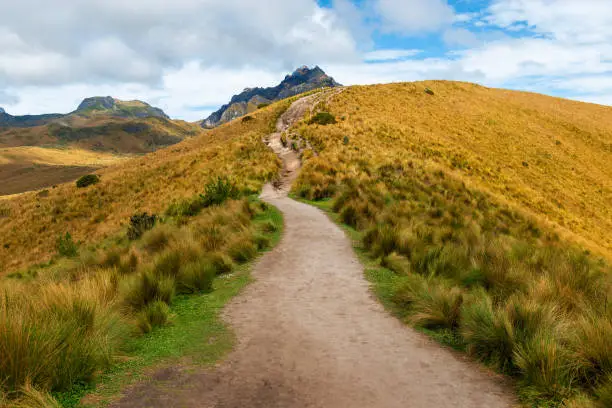
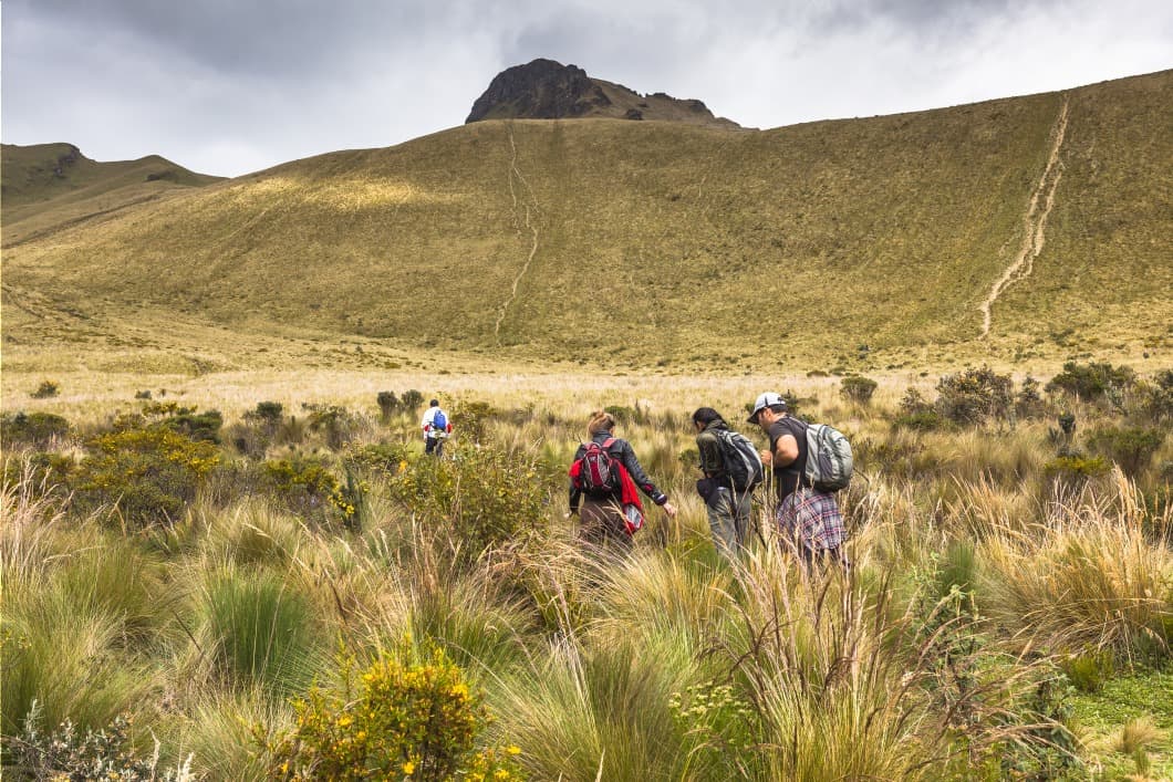
From the edge of Karikucha lagoon, a trail climbs the Fuya Fuya slope to its summit. The climb alternates grassy passages and steeper sections, sometimes slippery in wet weather. On clear days, the panorama opens onto Cayambe, Cotacachi and Imbabura.
The páramo and wildlife
The site is entirely covered in páramo vegetation: high-altitude grasslands, punas, alpine steppes with yellowed tufts of grass, small cacti. This ecosystem is home to high-altitude birds (caracaras, Andean hummingbirds) and, more discreetly, Andean foxes.
Practical information
- Altitude: departure at approximately 3,720 m, summit around 4,260 m.
- Hike duration: allow 3 to 4 hours round-trip from the lagoon parking area.
- Difficulty: moderate on technical grounds, more challenging due to altitude. Prior acclimatization of 1 to 2 days in Quito or Otavalo is recommended.
- Equipment: hiking boots, windbreaker, warm layers, sun protection, water and snacks. Weather changes rapidly.
- Guide: not mandatory, but useful for walkers unaccustomed to altitude or in misty conditions.
- Camping: possible around the lagoons. Some sites are paid and can be reserved in advance; elsewhere, simply find stable ground.
When to go
The dry season in the Ecuadorian Andes runs roughly from June to September, with a shorter window around December-January. These are the best periods to hope for a clear summit. By arriving early in the morning, you increase your chances of avoiding mist: peaks often cloud over by midday. Conversely, late afternoon can offer beautiful light over the lakes, provided you descend before nightfall.
Temperatures at the summit remain cool year-round (often between 0 and 10 °C), with marked wind.
How to get there
From Otavalo, follow the Panamerican Highway toward Tabacundo, then exit at Sucre Street. After a Y junction, take the road heading west, which climbs gradually to Mojanda lagoon. The track becomes rough on the last kilometers: a 4x4 vehicle is recommended, especially in wet weather.
Without your own vehicle, taxis or camionetas can be hired from Otavalo for the day, with waiting on-site. Allow approximately 45 minutes to 1 hour travel time from town.
What to combine in the region
The Otavalo region lends itself to several days of exploration. Nearby, you can extend your visit with:
- The Cuicocha lagoon, another spectacular caldera at the foot of Cotacachi.
- Otavalo's artisanal market, one of the most renowned in the Andes, ideal on Saturday mornings.
- The San Rafael waterfall, further east, for those heading toward the Amazon.
- Quito and its historic center, including the Church of the Company, approximately two hours' drive away.
Frequently asked questions
Frequently asked questions
Technically, it remains accessible: no climbing or specialized equipment required. The main difficulty lies in the altitude (over 4,200 m at the summit), which slows breathing and pace. Prior acclimatization and a slow pace are sufficient for most walkers in good health.
No, the trail is generally well-marked from the lagoon. A guide remains recommended if you are unaccustomed to altitude, if visibility is poor, or to benefit from explanations about the páramo and the site's geology.
It's possible but hectic: both sites are above 3,000 m, and combining them leaves little time for each. It's more comfortable to dedicate one day to Mojanda and another to Cuicocha, staying in Otavalo.
Yes, it's one of its most common uses. Reaching 4,200 m without technical difficulty allows you to test your altitude response before undertaking a more demanding ascent.
Prepare your trip
To integrate Fuya Fuya into a broader itinerary between Andes, Amazon and Pacific, consult our trips in Équateur.
Interested in this visit?
We can include it in your personalised itinerary.