Puntas
Puntas
A stratovolcano with 40 rocky peaks located 32 km from Quito, Cerro Puntas ranks among the finest acclimatization terrain in the Ecuadorian Andes.
Cerro Puntas is a mountain standing at 4,463 meters elevation, rising in Pichincha Province within the Eastern Cordillera, just at the edge of Cayambe Coca National Park. It remains an underrated attraction for trekkers and mountaineers visiting Ecuador. Yet it represents an excellent choice for acclimatizing before conquering the celebrated peaks exceeding 5,000 meters in elevation, such as Chimborazo and Cotopaxi.
Cerro Puntas, a Mountain Only Partially Tamed
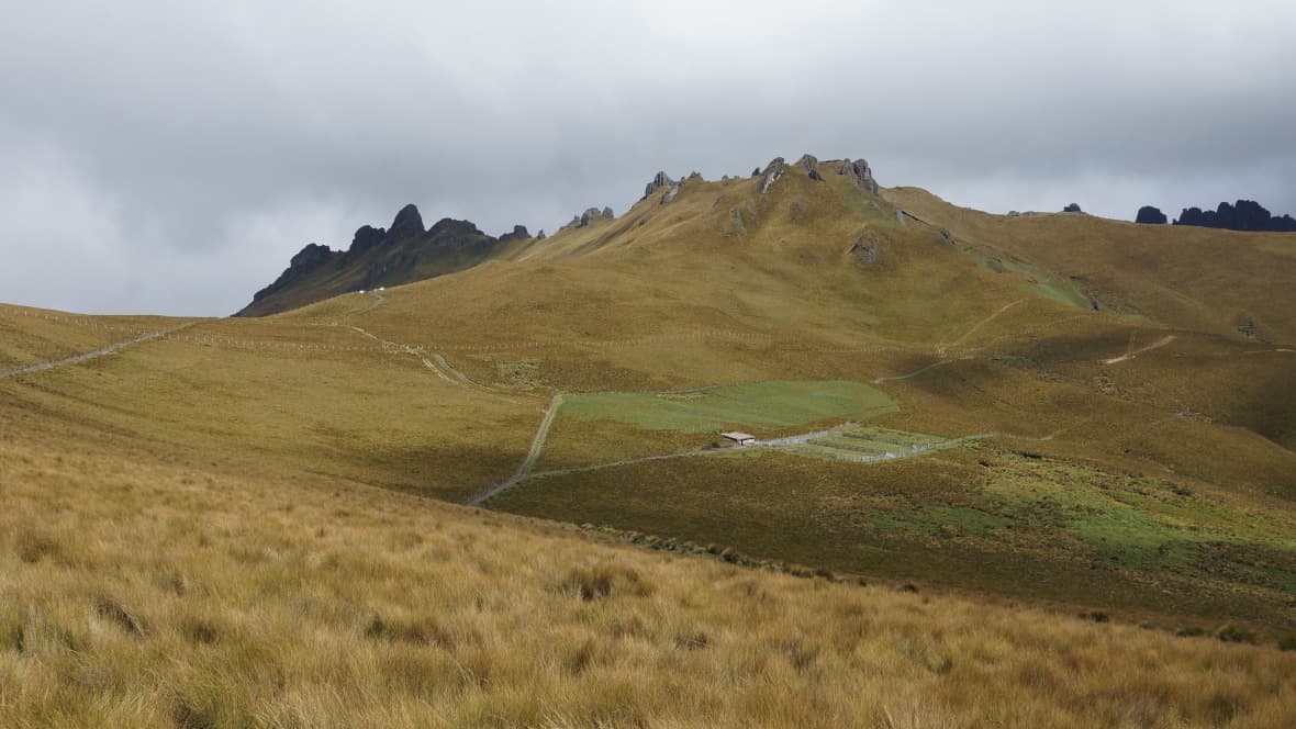
Cerro Puntas is a stratovolcano dating back to the Pleistocene. Its silhouette evokes an immense horseshoe, featuring two long chains of rocky peaks that, when viewed from a distance, resemble sawtooth ridges. Estimates suggest these two chains comprise between 40 and 50 peaks. At their center lies an open caldera, oriented toward the southwest. Sheltering the mountain's highest summit, the northwestern chain proves most favored among climbers. The southeastern chain, conversely, presents steeper challenges in terms of ascent, with increased humidity and the absence of marked trails. Consequently, its peaks are rarely—if ever—summited. This offers unexplored terrain for daring alpinists.
The Ascent
To reach the mountain's peaks, plan for a full-day excursion and traverse across haciendas. Most property owners permit tourists to cross their lands. At Hacienda Teresita, owned by the Ríos family, a passage fee of $2 per person is required.
Two important guidelines merit attention during your mountain exploration. First, ensure you leave no waste behind. Second, take care to close the gates of enclosures to prevent livestock from escaping.
Hikers have previously become disoriented on Cerro Puntas, primarily during descent. Indeed, the mountain remains shrouded in cloud cover much of the year. To avoid losing your way, always descend via the same route you ascended, and resist the temptation of shortcuts crossing pastures and moorlands.
Best Time to Visit
The optimal season for visiting Cerro Puntas falls during the dry season, spanning June through September. During these months, weather conditions prove more stable, with less rain and fog. This renders both ascent and descent considerably safer. However, conditions can vary from year to year. Thus, it remains advisable to check weather forecasts before deciding to attempt the climb.
Accessing Cerro Puntas from Quito
Cerro Puntas lies 32 km as the crow flies from Quito and 13.2 km from the town of Checa. Begin by heading toward the latter. Next, travel approximately 500 meters beyond the town's entrance before turning onto a narrow paved road to the right. Follow this road for roughly 7 km eastward, initially on pavement, then on a narrow and steep paved road, and you will arrive at Hacienda Teresita. This serves as the trekking starting point.
It is also possible to ascend Cerro Puntas from a hacienda situated at the foot of El Tablón mountain. To access it, continue toward El Quinche for about 3 km after reaching Checa. Before the road descends and crosses the final ravine, you will notice a paved road on the right leading toward the mountain. Follow this road and you will reach the farm's gate. From the highway, the journey spans approximately 7.6 km. Note that the highest section remains accessible only to 4×4 vehicles.
Want to discover this destination?
Our local advisors design your tailor-made trip.