Iliniza
Iliniza
Twin peaks 55 km south of Quito, an ideal acclimatization terrain before Cotopaxi and Chimborazo. Practical guide to Iliniza Norte and Sur.
Located in the provinces of Cotopaxi and Pichincha, 55 km south of Quito, in the western mountain range of the Andes, Iliniza—which means "the eyes" in Quechua—is a gray stratovolcano of the Holocene epoch. It serves as an excellent acclimatization route before venturing to higher elevations such as Cotopaxi. It also boasts one of Ecuador's finest hiking itineraries. This is why its summits are highly sought after and appreciated by tourists, both national and international, during a stay in Ecuador.
History
The Iliniza volcano once formed a single crater, but following a volcanic eruption that occurred during the Holocene, it was split into two. The two summits now bear the names of South Iliniza and North Iliniza. The first summit was climbed for the first time in May 1880 by two Italian guides: Jean Antoine Carrel and Louis Carrel.
Iliniza Today
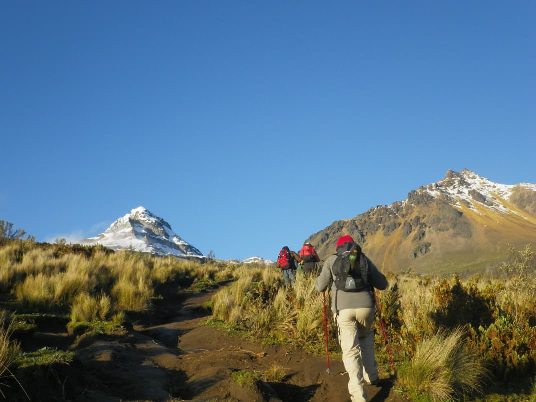
The Iliniza volcano has two summits. The southern peak is often snow-capped, while the northern peak is entirely rocky. The northern summit reaches approximately 5,126 m in altitude, while the southern one sits at over 5,248 m.
Climbing Mount Iliniza
It takes approximately 12 hours to reach the summit of Mount Iliniza. Experienced climbers may reach it in 6 hours. Generally, the hiking trail covers roughly 12.5 km. For less experienced hikers, it is advisable to opt for the northern summit rather than the southern summit (very difficult to climb). The latter offers several challenging routes, often reserved for professionals of steep and snowy slopes. Nevertheless, with its snow-capped summit blending into the clouds, it presents a breathtaking setting.
Thanks to its gentle slopes, Iliniza Norte offers superb hiking itineraries to fully enjoy the landscape. This place promises stunning views of the mountains and valleys surrounding the Ecuadorian Andes. This part of Iliniza is thus very popular for trekking because it is among the rare high altitudes in Ecuador that are not covered by glaciers at the summit.
Enjoying the Ilinizas Reserve
Hiking in the Ilinizas area also includes visiting the ecological reserve of the same name. Mount Iliniza is part of this ecological reserve located 55 km south of Quito. The reserve covers approximately 30,800 hectares of Paramo vegetation and vast expanses of subtropical forest. Therefore, it is perfect for appreciating the Polylepis forest, or "paper bark tree," the pyjonales, chuquiraquas, or puyas. During your excursion to Iliniza, you may also observe small mammals such as chucuris, opossums, foxes, Virginia deer, squirrels, and other small animals.
When to Climb Mount Iliniza
To climb Mount Iliniza, the periods between June/September and November/February are the best seasons. The weather is very clear and temperatures pleasant and moderate.
To reach Mount Iliniza, you can take buses from Quito at the Quitumbe bus terminal in the direction of Machachi. Two bus companies operate this route. Once you arrive in this village, you will need to change buses at a place called "Campo de la Virgen" for El Chaupi, then follow a 9 km road to the Ilinizas parking lot. This is the starting point of the hiking trail.
Want to discover this destination?
Our local advisors design your tailor-made trip.